Although most U.S. airports use the same three-letter location identifier for the FAA, IATA, and ICAO Rolle Airfield is only assigned 44A by the FAA.
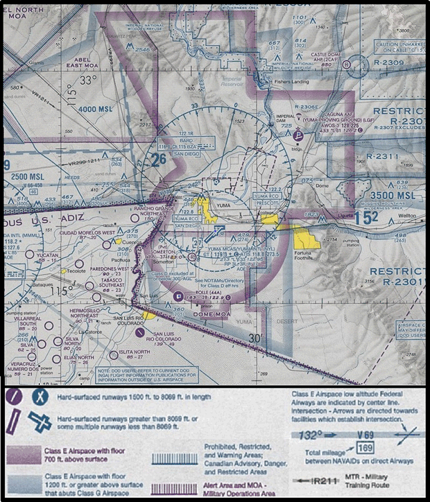
San Luis’s Rolle Airfield is located at the Southern boundary of the Dome MOA (which starts at 6,000'). The Class E airspace over Rolle Airfield begins at 1,200'. The airspace under the Class E airspace where Rolle is located is Class G (uncontrolled) airspace.
• Lat/Long: 32-30-58.7000N / 114-41-54.2000W / 32-30.978333N / 114-41.903333W
32.5163056 / -114.6983889 (estimated)
• 640 acres of remote desert environment
• CTAF 122.9
• Elevation 163’ (50 m) above mean sea level
• 10 mi on the 184 radial off Bard (BZA) VORTAC
• VFR Field
• No encroachment (3 mi radius)
• Weather Observation Station
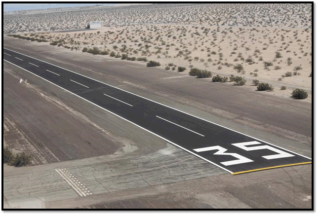
• 2800’ x 60’ newly paved runway
• Mil-Spec security includes an 8' chain link perimeter security fence with 3 strands of barbed wire along with an access controlled pedestrian gate door, and a 25’ rolling access controlled vehicle gate
• Fuel Provider – Million Air FBO delivery upon scheduled request
• Electric - Generator
• Water - Well
• Beamspeed internet provider
|